

Remote Sensing Analysis of Urban Growth
Project Details
Description
In this project, I explored and compared the growth of suburban sprawl in Guelph, Canada, and Winterthur, Switzerland from 2001 to 2021. My goal was to analyze the patterns and impacts of low-density, auto-dependent development in these regions, focusing particularly on how such development affects local ecosystems, infrastructure, and community quality of life.
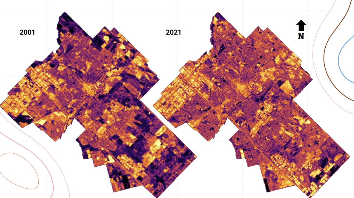
Utilizing Landsat 5, 7, and 8 images over the two decades, I performed a supervised classification to differentiate urban from non-urban areas. This classification helped in creating a Normalized Difference Built-up Index (NDBI), which effectively quantified changes in the built environment over time. My analysis revealed significant expansion in urban areas, particularly on lands previously designated for agriculture or as environmentally sensitive.
Throughout this period, both Guelph and Winterthur experienced notable population increases—30% and 27% respectively. This growth necessitated expanded urban infrastructure, which I analyzed through various socio-economic and environmental lenses. My findings highlighted several negative outcomes of urban sprawl, including increased air and water pollution, higher water consumption, and the degradation of human health. Notably, the sprawling growth led to increased infrastructure costs, wasted tax money, and social fragmentation among the community.
By comparing the sprawling growth in Guelph, which I identified as the epitome of sprawl, to the more controlled, mixed-use development in Winterthur—dubbed a 'mixed-use utopia'—I illustrated the contrasting approaches to urban planning and their long-term impacts on city sustainability and livability.
My research filled a critical gap in understanding small town sprawl and provided valuable insights that could aid policymakers and urban planners in making more informed decisions about sustainable urban development. This project not only underscored the importance of integrating environmental conservation into urban planning but also demonstrated how geospatial technologies could be leveraged to monitor and manage urban expansion effectively.